Saturday October 31, 2026 Hike Summary
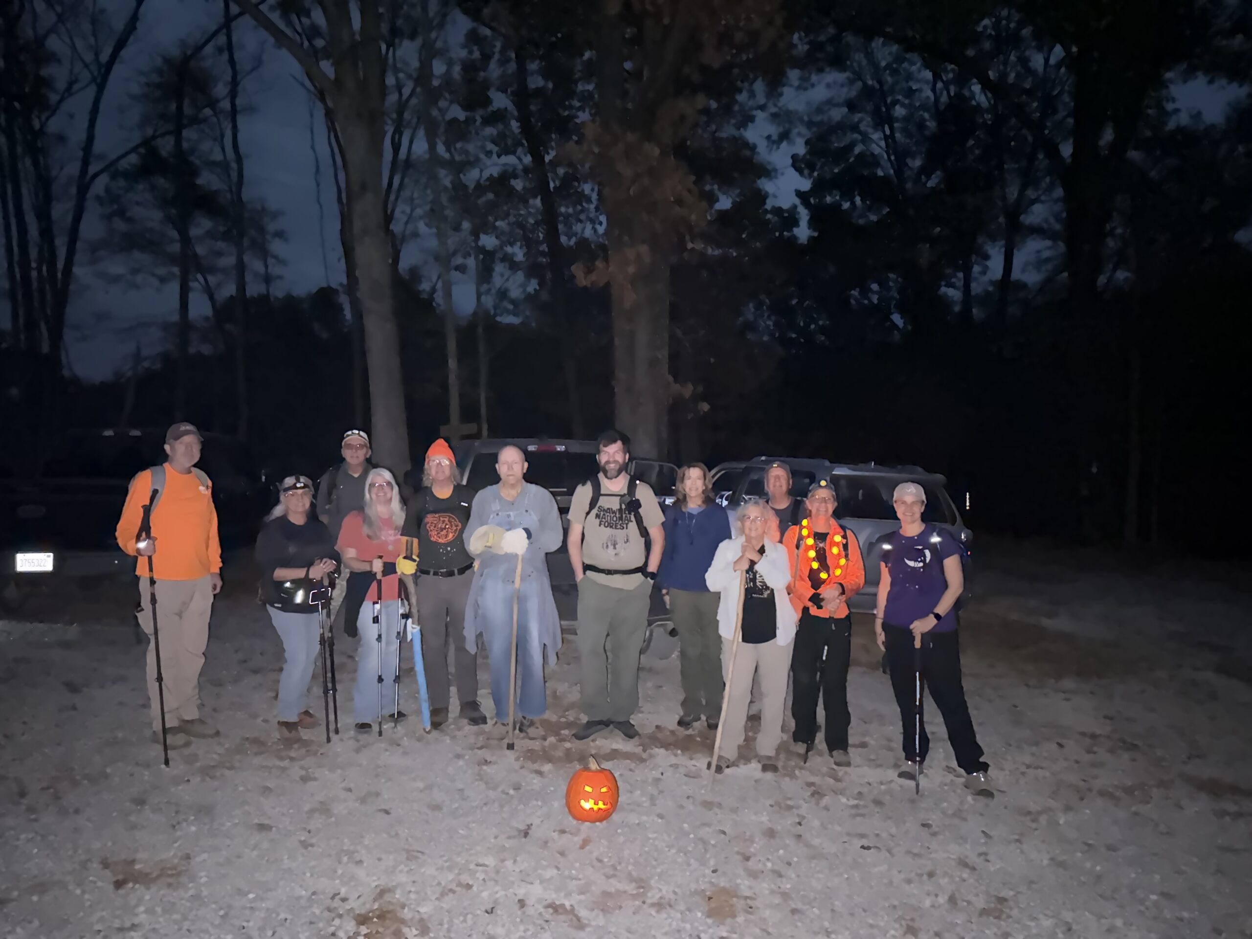
Halloween fell on a Saturday this year, so the River to River Trail Society could host its famous Halloween Night Hike at Max Creek. Max Creek is most often referred to as Max Creek Vortex. A “vortex” is an area with multiple reported paranormal activities, much like the famous Skinwalker Ranch. The legend behind Max Creek Vortex dates back to the 1800s; a whole family of settlers was murdered by the wife after she went crazy. People report seeing orbs of light, hearing strange noises, experiencing physical effects, seeing UFOs, and even the occasional Bigfoot sighting.

This Max Creek Vortex hike gave us an extra spooky detail. We had a total of 13 people hiking, A spooky number for a spooky trail on a spooky night.

Once we reached the creek (the Vortex area), the hike leader shared the legend and activated a battery-operated circular light to enhance the experience. The hike leaders had planted it earlier in the day when they hiked the trail in full to make sure it was all passable for the evening hike. The hike leader also shared his spooky experiences from his first visit to Max Creek.

The hike included a lit, carved pumpkin at the trailhead, and both the hike leader and Fred brought candy and some tricks for the hikers.

Another Max Creek Night Hike on the books, and No One Was Vortexed!

Saturday, October 31, 2026 Hike Announcement

The River to River Trail Society announces its 3rd public hike of the 2026 Fall hiking season on October 31st. This is an evening hike on Halloween. Hiking: Max Creek Vortex (if you dare). This hike is free and open to the public, Muhahaha. This will be a moderately difficult hike, approximately 4 miles in length, 3 hours hiking time. The leader of this hike can be reached at 618-694-7034 for more information. Hikers should meet at 6:30 pm at the end of Taylor Ridge Lane (Johnson County). For a map to the meeting location click the link, then click Directions. This hike is intended for people in very good health who have done some hiking. Hiking sticks and boots or sturdy shoes are recommended. Hikers should bring their own water and snacks. No dogs, please. Check the post on the River to River Trail Society website www.rivertorivertrail.net for this current week’s hike information. Prior to participating in any hikes, the River to River Trail Society requests that hikers read the Trail Society Waiver which can be found on the website at the following link https://rivertorivertrail.net/ under the Society Information tab. The waiver will be at the beginning of the hike.

Max Creek R2R Trail Detour Lifted

Hi All:

We were notified today by the Shawnee National Forest Service personnel that the April 1 – July 2026 R2R Trail detour in the Max Creek area has now been lifted. This detour was necessary because of ongoing work in the area to salvage the trees downed by the tornado that went through the Max Creek area in 2024. This detour was previously shown in this post. https://rivertorivertrail.net/april-1st-through-july-1st-r2r-trail-reroute-in-the-max-creek-area/

Use of the temporary detour map is no longer necessary and the original trail map marks the official trail.

Thanks

River to River Trail Society.

Saturday October 12, 2024 Hike Summary

On Saturday October 12th, 14 hikers met at the New Simpson Hill school on a beautiful morning, full of sun and very favorable hiking temperatures. Bill Gilmour was the leader again today, and after group introductions, we loaded into vehicles and headed South on U.S. Rt. 45 for a couple of miles, before turning East to go down Taylor Ridge lane. We headed down the trail to Max Creek. Todays’ hike was kind of a ‘reverse” hike, in some ways, of hikes we have done in years past. We did have 1 new hiker from the Logan/Thompsonville, IL. area. We, early on, saw another snake today, a black rat snake, that several stopped to watch it climb a small tree. A stop was made at an overhang bluff called Cougar cave, then we continued on down to Max creek. We crossed it multiple times during the hike. It had water, but, little to no flow. We made a quick stop at a waterfall spot that we have often ate lunch at on previous hikes, but, kept moving on down the trails. We got to the vortex, and also found the picnic table that was set out last year by some hard-working Trail Society members. It was still safe & sound. We made it to Gay cave for our lunch stop and group picture. Several got up into the rock “fort” that had been constructed. We moved out, and did some bushwacking along the lower part of a bluff, then climbed up onto the bluff, and worked our way out. We hiked about 4.5 miles for the day. We also saw 2 equestrian groups during the hike. 

Next weeks’ hike will be on the Tupelo Trail North of Belknap. 

Until then, “See ya’ll On the Trail”

Saturday, October 12, 2024 Hike Announcement

The River to River Trail Society announces its 2nd public hike of the 2024 fall hiking season on Oct. 12th. Hiking: Max Creek (Johnson County). This hike is free and open to the public. This will be a loop hike approximately 5.5 miles in length. The leader of this hike can be reached at 270-331-1553 for more information. Hikers should meet at 10:00 am at New Simpson Hill School. This hike is intended for people in good health who have done some hiking. Hiking sticks and boots or sturdy shoes are recommended. Hikers should bring their own water and snacks. No dogs please. For a map to the meeting location at New Simpson Hill School click this blue link New Simpson Hill School  and a map will open up, and then click the Directions button and a driving map will be created which will allow you to plan your driving directions to the meeting area. Prior to participating in any hikes, the River to River Trail Society requests that all hikers read the 2023 Trail Society Waiver which can be found on the River to River website at the following link River to River Trail Society Information and then sign off on this waiver prior to the beginning of the hike. A copy of the waiver will be at the New Simpson Hill School meeting area for your signature.

Max Creek Section Cleared

On Feb 1, 2024, two Trail society board members got together and cut approximately 35 trees that had fallen across the Max Creek section of the River to RIver Trail. Most trees were only 4-6 inches in diameter, however we did encounter 4-6 that were 14-12 inches in diameter plus one that was approximately 28 inches in diameter. The trail is now clean from Taylor Ridge Road to Hilltop Lane except for one large tree near Hilltop Lane that is easy to walk around. Thanks go to Bill Gilmour and Sam Morales.